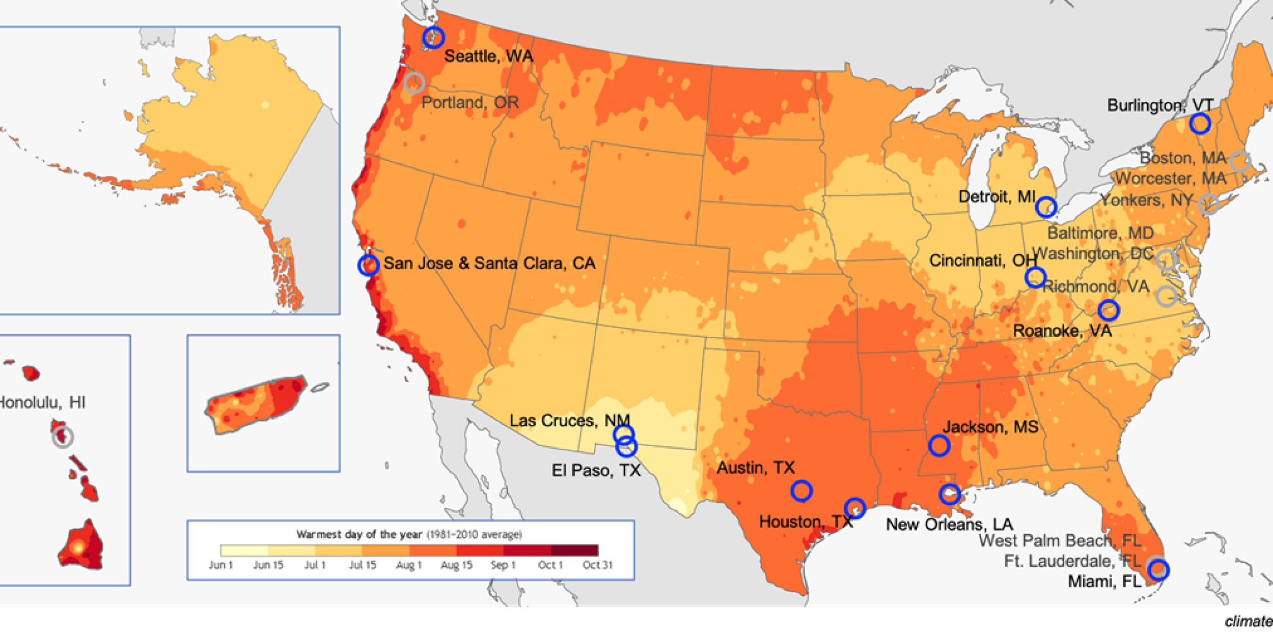
The National Integrated Heat Health Information System (NIHHIS), in partnership with the NOAA CPO Communication Education and Engagement division and CAPA Strategies LLC will support and coordinate 13 community science Urban Heat Island (UHI) mapping field campaigns in cities across the country this summer. The cities in the 2020 cohort were the highest ranked applicants in a competitive process to determine which communities had the greatest need, most promising partnerships, and clearest applications identified for the resulting information.
- Austin, TX
- Burlington, VT
- Cincinnati, OH
- Detroit, MI
- El Paso, TX
- Houston, TX
- Jackson, MS
- Las Cruces, NM
- Miami, FL
- New Orleans, LA
- Roanoke, VA
- Seattle, WA
- San Jose / Santa Clara, CA


Each campaign is led by a core partner or group of partners — often city sustainability offices, environmental NGOs, or health departments — and is carried out with an even larger, multidisciplinary set of other partners. Operations and scientific analysis are supported by CAPA Strategies, which has developed an engaging and easy-to-implement process for running the campaigns. This year, due to COVID-19 physical distancing constraints, CAPA has developed plans to run these campaigns with minimal person-to-person interaction by shipping sterilized sensing gear to host organizations and hosting online orientation and training sessions with local campaign teams and their volunteers.
NOAA is providing climate and weather predictions and funding support to the campaigns, and will also sustain engagement during and after the mapping activities through the NIHHIS network.
This year represents the third year running that the Climate Program Office has supported these urban heat island mapping efforts. The inaugural year was funded via an environment literacy grant awarded by NOAA’s Office of Education. The mapping campaigns are just the beginning of a series of beneficial returns on the investment. Past campaign engagements and datasets have seeded workshops on urban heat at museums, new research into optimal urban forestry approaches to minimize the UHI effect, and exploration of UHI interventions and potential policy changes within city governments to protect people as well as built and natural systems from the adverse effects of extreme heat.
For additional information, please visit nihhis.cpo.noaa.gov/Urban-Heat-Island-Mapping


