

NIDIS, the CPO-led National Integrated Drought Information System, has launched a redesigned U.S. Drought Portal to better serve stakeholders, decisionmakers, the media, and the public.
The new website, Drought.gov, features updated content and new interactive architecture designed to provide actionable, shareable information, and easy-to-understand graphics describing current drought conditions and forecasts by city, county, state, zip code, and at watershed to global scales. Drought.gov aggregates and presents drought impact data for economic sectors such as agriculture, energy, water utilities, tourism and recreation, bringing together interactive maps and data in one place, which you won’t find anywhere else.
“The new Drought.gov will help communities and economies across the United States understand and manage drought impacts,” said Veva Deheza, Executive Director of NIDIS. “Whether you’re looking for conditions in your neighborhood, or you’re an elected official responsible for water management decisions, Drought.gov is designed to be a one-stop shop for drought information, decision-support products, and educational resources.”
Drought.gov now features a new sector impact section, with information on how drought is impacting agriculture, water supply, recreation, wildfire management and more. Credit: NIDIS
Drought.gov has four major new features:
- City and county level conditions: Explore current conditions, key indicators of drought, outlooks, forecasts, and historical drought conditions. Local drought data can assist with
 monitoring drought conditions at greater levels of granularity and evaluating local mitigation measures.
 - Historical data and maps: View U.S. Drought Monitor data going back 20 years, standardized precipitation index (SPI) data going back 125 years, and paleoclimate data (e.g., from tree-ring analysis) going back 2,000 years. These data sets allow you to compare historical and current conditions even at the county level. By looking back at historical data, communities can get a better understanding of the drought and extreme weather threats to plan for and to be prepared for.
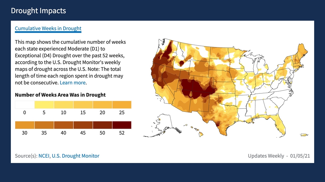
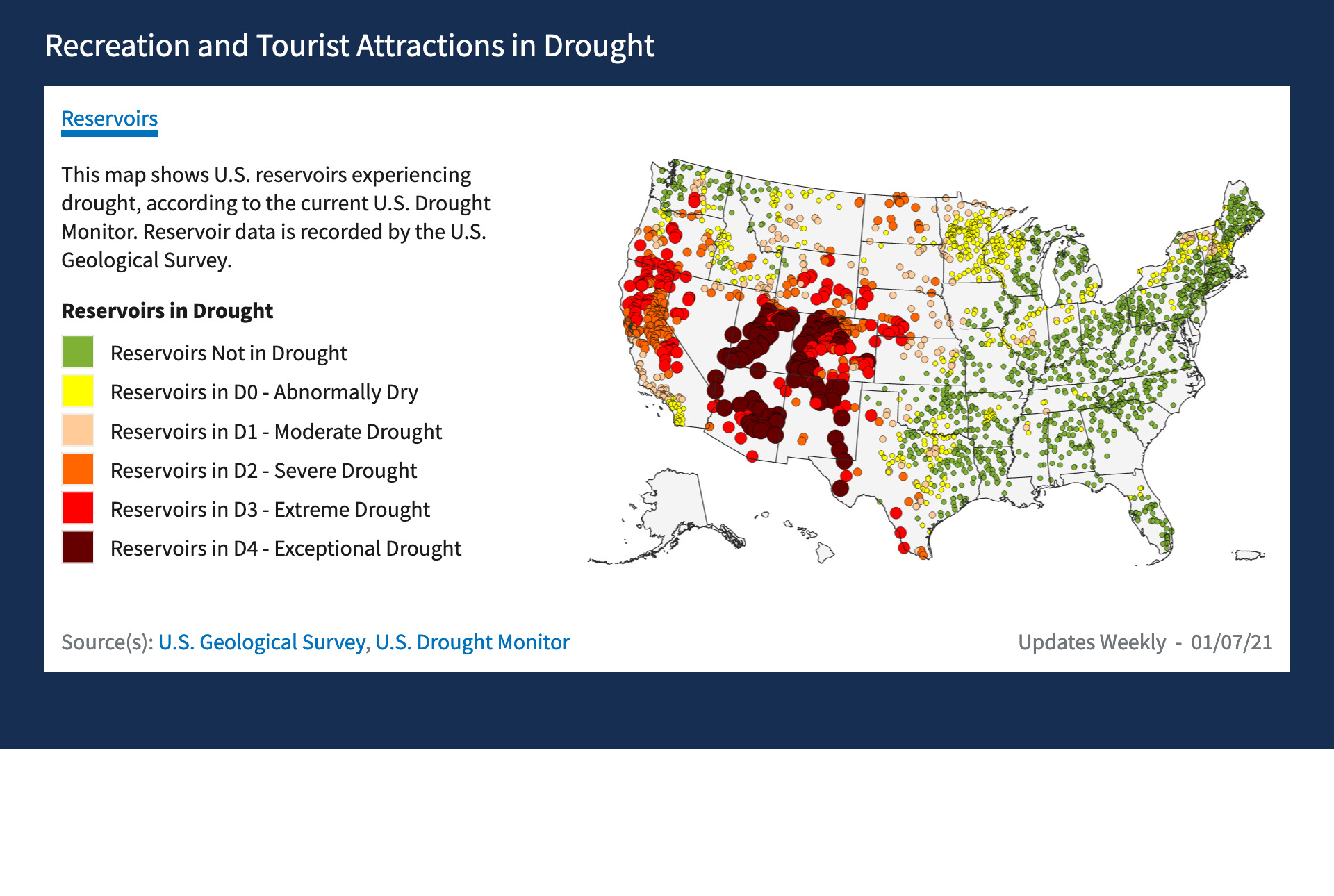
- Sector impacts: Explore drought impacts in a new comprehensive resource of economic sector data, such as agriculture, energy, water utilities, and tourism and recreation. For example, reductions in snowpack and stream flows directly affect outdoor recreation and tourism – snow sports like skiing and snowmobiling, and water sports like boating, rafting, canoeing, fishing, and swimming. The maps in this section display U.S. recreation and tourism attractions currently in drought, including ski areas, national parks, and reservoirs. Additionally, Drought.gov now provides updated snow drought information, streamflows, information on active wildfires, wildfire outlooks, and more.
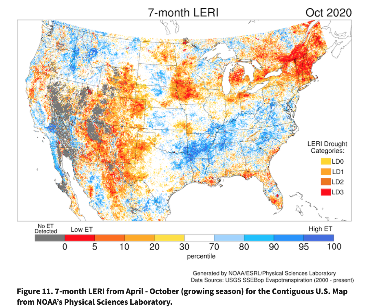
- Research and Learn: Go “back to the basics,” learn about flash drought, snow drought, new NOAA drought research tools like EDDI and LERI, and initiatives like the National Coordinated Soil Moisture Monitoring Network. This section also includes links to ongoing and published NIDIS research designed to help build resilience to drought across the United States.
 monitoring drought conditions at greater levels of granularity and evaluating local mitigation measures.
Watch this demonstration video to learn more about the new Drought.gov.


")


