


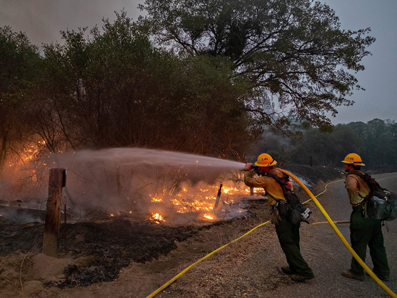
Firefighters work to contain the Creek Fire in Sierra National Forest in California on 10 September 2020. Credit: Pacific Southwest Forest Service, U.S. Department of Agriculture
In a new EOS Opinion Article, MAPP Drought Task Force leaders Rong Fu, Andrew Hoell, Justin Mankin, and Isla Simpson, working with NIDIS staff member Amanda Sheffield describe the disastrous impacts droughts, heat waves, and fires have in the United States and world, and new MAPP- and NIDIS-funded research that’s tackling the challenges of a drier, hotter, more fire-prone future.
With wildfires in the western United States burning nearly 3.56 million hectares (8.8 million acres) in 2020, or about 75% more area than expected in an average year, it’s important to know how droughts, wildfires, and heat waves interact. How do they shape each other’s likelihoods, magnitudes, and impacts?
Research shows that simultaneous droughts and heat waves can substantially increase fire risk and the scale of burned areas. However, the degree of their impacts varies between different fire regimes and histories. What’s less clear is how largely-burned landscapes will shape atmospheric conditions favorable to droughts and extreme heat in coming years.
Researchers note that with La Niña and warm North Pacific sea surface temperature anomalies lasting into early 2021, drought-favorable conditions are likely to persist over much of the western United States. This raises the question, “Will drought or extreme heat be established more quickly and intensely in newly burned regions or cause fire-favorable weather elsewhere?”
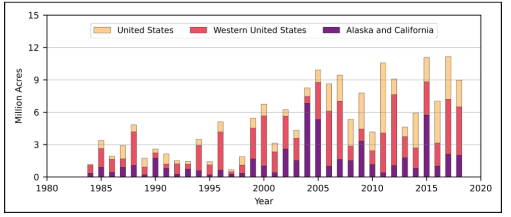
Annual area burned from 1984 to 2018 in the United States in total, in the western United States, and in Alaska and California combined based on data from the federal Monitoring Trends in Burn Severity database.
Researchers note two challenges in advancing the science and responses to drought-heat wave-wildfire events. The first being that feedbacks involved in shaping these compound events are poorly understood, in part because there have been too few examples to identify and model. The second challenge are the barriers between disciplines and researchers in the study and risk management of these events. For example, drought researchers focus on variations in moisture supply (e.g., rainfall) as the primary cause of drought, whereas wildfire experts focus on the moisture demand of the atmosphere. To address these barriers between research disciplines requires collaboration among scientists with widely varying expertise, from climate physics, hydrology, and ecology to fire behavior and management science, air and water quality, and public health and infrastructure engineering.
In the past decade, coordinated efforts among scientists have significantly advanced drought research and early-warning capabilities. NOAA’s Drought Task Force (DTF), for example, is composed of U.S. drought experts selected through a competitive proposal process run by NOAA’s Modeling, Analysis, Predictions, and Projections (MAPP) Program in collaboration with the National Integrated Drought Information System (NIDIS). Over its 10-year history, the DTF has led community research efforts to study drought causes, predictability, modeling, and monitoring that enhance early-warning capabilities in support of the NIDIS mission.
DTF and NIDIS have drawn top researchers from different disciplines to work together to address science questions central to drought early warning and management, especially those identified by stakeholders. For example, during the 2011 Texas, 2012 Great Plains, and 2012–2016 California droughts, the DTF addressed the increasingly important role of heat in shaping these extreme events through timely reports about their dynamic causes, such as the role of sea surface temperature variability and anthropogenic forcing in producing them.
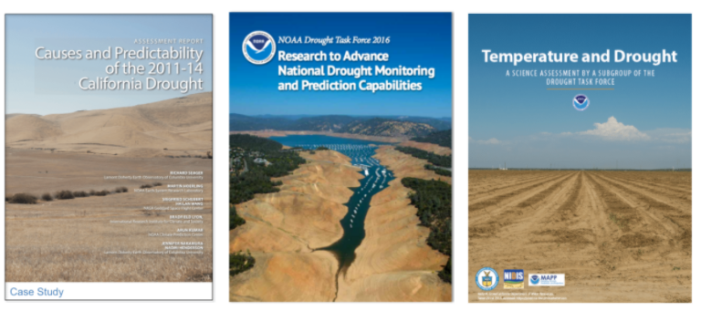
Drought reports published by the MAPP Drought Task Forces, in collaboration with NIDIS.
The wildfire and climate research communities have already begun collaborating to create wildfire early-warning systems. For example, the U.S. Forest Service Wildland Fire Assessment System (WFAS), which is supported by the National Interagency Coordination Center (NICC), uses real-time drought and temperature information provided by NOAA to assess wildfire risk.
Meanwhile, the DTF supports projects that investigate the impacts of wildfire on clouds, precipitation, snowmelt, and streamflow over the western United States through both observational analysis and regional model simulations. And a growing body of research is aimed at developing a framework to characterize and quantify compound effects of droughts, heat waves, and wildfires. These, together with other existing efforts, will inform Earth system models with improved representations of ecosystem-fire-climate interactions, which, in turn, will ultimately enable researchers to dissect the underlying mechanisms of coupling among droughts, heat waves, and wildfires.
Read the full article here.