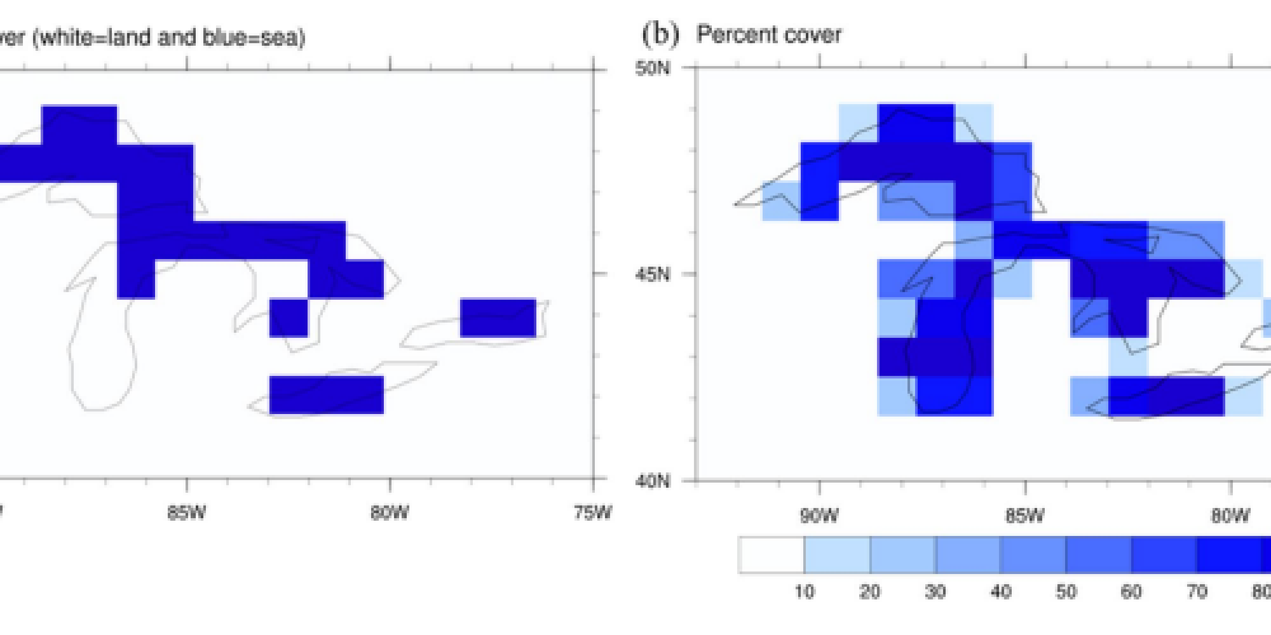
Land-sea cover in CFS (a) and lake percent cover in CFS-FLake (b) over the Great Lakes
Over the last several decades, climate models have significantly improved due to enhancements in technology and data. However, producing reliable climate forecasts remains a challenge due to the climate models’ inability to include local and mesoscale land and atmospheric processes. Climate models are unable to incorporate these processes due to coarse spatial resolutions, yet the processes play a significant role in the atmosphere.
In a new article in Climate Dynamics, scientists Zhemin Lv, Shaobo Zhang, and MAPP-funded PIs Jiming Jin, Yihua Wu, and Michael Ek coupled a two-layer one-dimensional Freshwater lake (FLake) model in the Climate Forecast System (CFS) version 2 to improve simulations of the effects of the Great Lakes in winter climate forecasts. Lakes and land differ in surface roughness, reflectance, and heat capacity; therefore, interactions between lakes, land, and the atmosphere strongly influence weather and climate. For this project, ensemble retrospective forecasts with CFS-FLake for the period of 1997-2016 with 9 monthly leads were assessed to better understand the role of the Great Lakes in winter, when significant lake-effect precipitation occurs.
The study found that CFS-FLake forecasts were consistently better than those with only CFS. This resulted from the change of ocean and land in CFS to lakes in CFS-FLake. When a freshwater lake was added, the resulting model indicated that lake surface temperature decreased with increasing lake ice coverage. This resulted in lower surface heat and water fluxes to the atmosphere during the winter. In addition, precipitation predicted by the CFS-FLake was reduced significantly over the Great Lakes due to suppressed rising motion from a stable atmosphere.
Results from this study indicate that local and mesoscale surface and atmospheric processes significantly affect regional climate forecasts. In addition, the CFS-FLake model has enhanced the understanding of lake influences on weather and climate.
———————————————————————————————–
About MAPP
The Modeling, Analysis, Predictions, and Projections (MAPP) Program is a competitive research program in NOAA Research’s Climate Program Office. MAPP’s mission is to enhance the Nation’s and NOAA’s capability to understand, predict, and project variability and long-term changes in Earth’s system and mitigate human and economic impacts. To achieve its mission, MAPP supports foundational research, transition of research to applications, and engagement across other parts of NOAA, among partner agencies, and with the external research community. MAPP plays a crucial role in enabling national preparedness for extreme events like drought and longer-term climate changes. For more information, please visit www.cpo.noaa.gov/MAPP.


