by: Howard J. Diamond, PhD (NOAA’s National Centers for Environmental Information)
The 2014/15 Tropical Cyclone Season was a very interesting and unique year. The seasonal outlook issued in October 2014 originally called for 8-12 named storms with one Australian Category 5. Predictions were based on similar years with El Niño neutral or weak seasons.


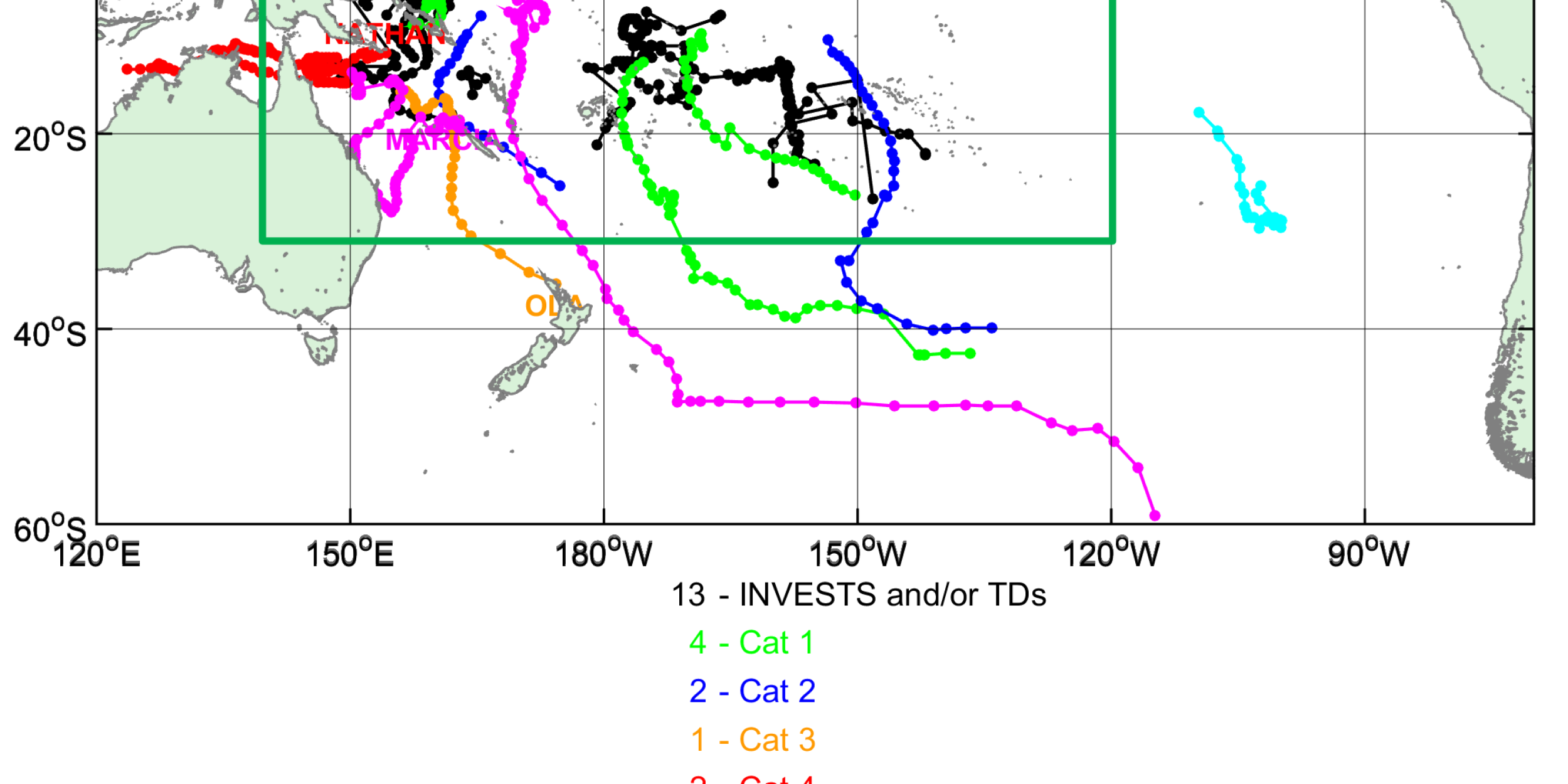
There were a total of 11 named storms with 2 category 5 storms (Pam and Marcia)! Pam at one point had winds of 145 knots (~166 mph) as it impacted the island state of Vanuatu.


As the year continued, El Niño conditions grew stronger and led to the formation of two cyclone twin pairs. One of these storms (Raquel) was the first named storm to exist in the South Pacific in July.
Finally, a unique sub-tropical storm formed off the coast of Chile (not a normal area for these storms). In fact, such storms are so rare in this area that there is not even a global tropical cyclone monitoring center responsible for monitoring this area. However, researchers found this system and named it Katie (future publication in Nature). With the building El Niño, sea surface temperatures in this area are increasing and as noted in the figure of sea surface temperature anomalies, waters were as much as 1.0° Celsius above the 30-year normal.
Overall, the 2014/15 tropical cyclone season in the Southwest Pacific had some unique features to it, with early indications that the upcoming 2015/16 season could be quite active. An early tropical cyclone developed in the Solomon Islands in August 2015, which could be an indicator of a strong El Niño. The last time a strong El Niño event occurred was in 1997, which started with two tropical cyclones in October.


Reference:
Reynolds, R.W., T.M. Smith, C. Liu, D.B. Chelton, K.S. Casey, and M.G. Schlax, 2007: Daily High-Resolution-Blended Analyses for Sea Surface Temperature. J. Climate, 20, 5473-5496.


