
Climate Program Office Climate Risk Areas Initiative and MAPP
Communities across the country are faced with multiple impacts of a changing climate, such as increased flooding and drought variability, altered precipitation patterns, and more frequent terrestrial and marine heatwaves. The Climate Program Office (CPO) in 2019 identified four areas of climate risk around which CPO’s research and communications divisions could collectively focus. CPO is piloting this strategic effort to address America’s most pressing climate challenges by applying science to improve capabilities and support user-driven needs.

How does MAPP science support the CPO climate risk areas?
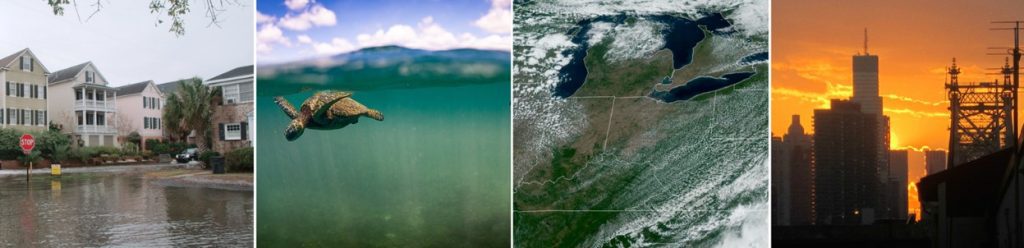
Coastal Inundation
Coastal Inundation, led by Sandy Lucas: Targeted investments in support of NOAA’s larger mission to protect coastal communities from flooding and inundation
Build a cross-NOAA research agenda and action plan supporting the next generation of research and modeling around inundation in a climate context and meet the demand for more on-the-ground engagement and capacity building for coastal decision makers.
Marine Ecosystems
Marine Ecosystems, led by Ginny Selz: Climate research and modeling to improve long-term planning and management of our National Marine Sanctuaries
Reinforce and expand the application of climate science in National Marine Sanctuaries activities to support NOAA’s Stewardship mission.
Water Resources
Water Resources, led by Nancy Beller-Simms: Providing actionable intelligence to help water utilities and city planners in the Great Lakes Region better manage their water infrastructure and protect citizens who are vulnerable to flooding.
Enhance the decision-making and adaptive capacity of Great Lakes water utility managers by developing integrated climate-flooding risk and socioeconomic information that will be utilized for near-term management of resources and people, emergency response planning, and long-term infrastructure design.
Extreme Heat
Extreme Heat, led by Hunter Jones: Urban Climate Science to promote Heat-Healthy Cities
Urban climate and health problems are complex, requiring nuanced solutions. For example, urban heat islands contribute to health effects such as heat illness and death, but may have an inverse relationship with urban air pollution, such that actions to mitigate urban heat could diminish air quality and increase respiratory disease. Thus urban climate and health issues and their solutions may be subject to both co-benefits and undesirable side-effects. The Extreme Heat Risk Area focuses on enabling cities to monitor, model, and predict urban-scale climate, and applying this understanding to informing and evaluating risk-reducing decisions in urban areas.
The four climate risk areas that CPO is focusing on through this new initiative. CPO formed teams to develop collaborative proposals that target specific stakeholders’ needs in each climate risk area. Click each topic to learn more about the four climate risk area proposals.
MAPP invests in research to advance climate and Earth system modeling to simulate climate variability and climate change that undergirds our understanding of changes in the climate system and helps scientists understand and contextualize current-day climate conditions and extremes. MAPP’s investments target the research space at the transition between fundamental climate process research and applications, and the investments are tied to products and services provided by NOAA. MAPP plays a vital role in meeting the societal challenges created by climate variability, change, and impacts relevant to the CPO risk areas.
Working with partners, MAPP supports research on climate variability and change, prediction, monitoring, and modeling targeting issues such as drought, extreme heat, flooding, changing sea levels, and marine ecosystem impacts. Many of MAPP’s recent funding efforts aligned closely with the four CPO risk areas and laid the groundwork for R&D supporting these risk areas. Since 2017, MAPP has funded projects totaling over $30 million toward research into Coastal Inundation, Marine Ecosystems, Water Resources, and Extreme Heat; and the development of modeling, prediction, projection, and monitoring capabilities related to these climate risks.
1) Coastal Inundation
*Since 2017, MAPP has awarded over $4.3 million towards coastal inundation research.

- Starting in FY21, MAPP funded research projects that will identify processes controlling the representation of coastal sea level in climate models, and an unprecedented coastal water level model reanalysis for coastal inundation and flood risk assessment.
- In FY17, MAPP funded two research projects to explore seasonal prediction of coastal high water levels that result from seasonal variations in climate modes such as the El Niño–Southern Oscillation, regional dynamics such as the Gulf Stream, and tidal phases in combination with longer-term climate trends.
- These projects collaborated and coordinated as part of the Marine Prediction Task Force to optimize outcomes toward the development of enhanced coastal flooding predictions.
Click here to see other MAPP-funded coastal inundation projects
2) Marine Ecosystems
*Since 2017, MAPP has awarded over $10 million toward marine ecosystem research.

- For FY22, in partnership with COM, CSI, NCCOS, OAP, and IOOS, MAPP is involved with two funding solicitations to support science relevant to the Marine Sanctuaries and Monuments managed by NOAA. MAPP will bring climate and regional modeling to bear on understanding, prediction, and projection challenges in the Sanctuaries system.
- In an enduring partnership with NOAA’s Fisheries Service, MAPP has funded two significant sets of projects (in FY17 and FY20) focused on prediction, projection, and modeling of marine ecosystems, and has organized a Marine Ecosystems Task Force to support this research area.
- The focus of the FY17-20 Fisheries projects was on developing seasonal to interannual forecasting capabilities for fisheries and other marine living resources with a regional focus on the U.S. West Coast, Northeast U.S. Shelf and Eastern Bering Sea. This capability laid the foundation for NOAA’s Climate Ecosystems and Fisheries Initiative.
- FY20-23 projects focus on regional modeling and climate forecasts, numerical representation of biogeochemistry, quantification of the biophysical links between ecosystems and climate forcing drivers. MAPP has organized Task Forces to lead and create collaboration between the research projects.
Click here to see other MAPP-funded marine ecosystem projects
3) Water Resources
*Since 2017, MAPP has awarded over $15 million towards water resource research.
-resize409x296")
- MAPP has a long and persistent record of supporting drought research in partnership with NIDIS. Since 2011, four consecutive Drought Task Forces were funded and organized by NIDIS and MAPP; the latest commenced in 2020. The Drought Task Force was established to achieve significant new advances in the ability to understand, monitor and predict drought over North America. An integrated drought prediction system has been developed with the support of numerous research projects. Capabilities developed from these research projects inform water resource management across the country.
- MAPP has also funded work that uses the Coupled Model Intercomparison Project data to produce integrated climate projections and develop model diagnostics. Projection projects are focused on a wide range of water-resource issues including seasonal snow cover, western hydro-climate, rain-on-snow flooding events, and flooding and extremes driven by mid-latitude synoptic weather patterns. Diagnostic activities are focused on benchmarking model deficiencies related to the movement of water throughout the atmosphere, precipitation patterns and behavior, and land surface-atmosphere interactions.
4) Extreme Heat
*Since 2017, MAPP has awarded over $1.7 million towards extreme heat research.

- In FY21, MAPP has funded projects that will work to develop a comprehensive flash drought monitoring framework, analyze century-scale variations and trends in heat stress metrics, and create a Heat Vulnerability Index (HVI) to study US Southeast heat vulnerability.
- MAPP has funded a series of projects over the past decade focused on extreme heat. The North American Multi -Model Ensemble (NMME) prediction system has been leveraged to extend the prediction skill of the subseasonal excessive heat outlook system with a focus on human health.
- Projects have been funded focused on Subseasonal to Seasonal (S2S) variability of heat events, S2S predictions of heat waves, and predictability of drivers of heat waves.
- Efforts to understand the linkages between drought and heat waves and compound extremes (where different extremes may challenge societal resilience in parallel or sequence).