


New line of information could help predict the storms’ future strength
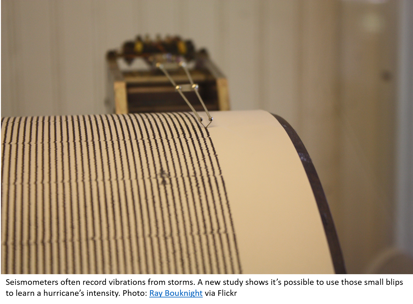
The earth is a noisy place. Seismometers, which measure ground movements to detect earthquakes, volcanic eruptions, and manmade explosives, are constantly recording smaller vibrations caused by ocean waves, rushing rivers, and industrial activity.
“We call this ‘ambient seismic noise’ because for people interested in earthquakes, it’s not very useful,” says geoscientist Lucia Gualtieri. “But it’s not random noise.”
In a new study, lead author Gualtieri (now with Princeton University) and her colleagues have found that those seemingly trivial blips can actually encode the power of hurricanes moving over ocean waters. The findings may make it possible to estimate the strength of past hurricanes, to reveal long term changes in the severity and frequency of these storms, and help scientists understand potential future changes.
Seismic Fingerprints
Scientists have known since the beginning of the 20th century that large storms in the ocean, including tropical cyclones (also known as “hurricanes” and “typhoons”), leave their signatures in seismic data. The signal comes from the ocean waves generated by the hurricane’s strong winds. But they’re not just any waves. “The waves you see when you go to the beach are not enough,” says Gualtieri.
Instead, tropical storm vibrations mainly come from complex interactions between waves, and from pressure fluctuations at the top of the ocean, which generate up and down movements in the water column. Those waves hit the seafloor and vibrate the earth.
Although hurricanes have been known to leave a fingerprint in the seismic record, extracting much useful information from those fingerprints has proven difficult, until now.
Sound Science
Most previous studies trying to extract tropical cyclone data from seismic noise focused on individual storms. By contrast, Gualtieri and her colleagues analyzed 13 years of tropical cyclones in the northwest Pacific Ocean.
The team used data from seven seismometers stationed in eastern Asia and on islands in the Pacific. “Seismic waves propagate throughout the planet,” Gualtieri explained. “It doesn’t matter if the seismometer is at bottom of the ocean or on land, you can detect those signals everywhere on Earth.”
The team found that a computer algorithm could estimate hurricane intensity based on seismic data alone and that the estimates matched well with satellite measurements. This suggests that the signatures in the ambient seismic noise can be a reliable source of information about tropical cyclones.
 Looking Ahead
Although seismic data can’t compete with satellite information when it comes to making hurricane forecasts, it could help to improve the understanding of future changes by extending our records back in time.
Models suggest that climate change is making hurricanes more intense. However, observations are limited, because satellite measurements of hurricane intensity only date back to the 1960s and 70s.
“It’s always a problem when we try to see if there are trends or not, because our data sets are too short,” says co-author Suzana Camargo, who studies tropical cyclones at Lamont-Doherty Earth Observatory.
Seismic recordings, on the other hand, could let scientists look further back in time. After the team refines its algorithm with more data from other ocean basins, the seismic record could add several decades to our knowledge of tropical cyclone activity.
That, in turn, would help climate scientists predict what’s going to happen to hurricanes in the decades to come, says Camargo.
This study, published in Earth and Planetary Science Letters, was supported in part by NOAA Research’s Modeling, Analysis, Predictions, and Projections (MAPP) Program.
About MAPP
The Modeling, Analysis, Predictions, and Projections (MAPP) Program is a competitive research program in NOAA Research’s Climate Program Office. MAPP’s mission is to enhance the Nation’s and NOAA’s capability to understand, predict, and project variability and long-term changes in Earth’s system and mitigate human and economic impacts. To achieve its mission, MAPP supports foundational research, transition of research to applications, and engagement across other parts of NOAA, among partner agencies, and with the external research community. MAPP plays a crucial role in enabling national preparedness for extreme events like drought and longer-term climate changes. For more information, please visit www.cpo.noaa.gov/MAPP.
View More MAPP News.