Research supported by CPO’s Modeling, Analysis, Prediction, and Projections (MAPP) program was published online in the Journal of Geophysical Research: Atmospheres.
The paper “Application of USDM statistics in NLDAS-2: Optimal blended NLDAS drought index over the continued United States,” focuses on a testing a new method to improve drought monitoring based on NLDAS and is part of the Drought Task Force efforts.
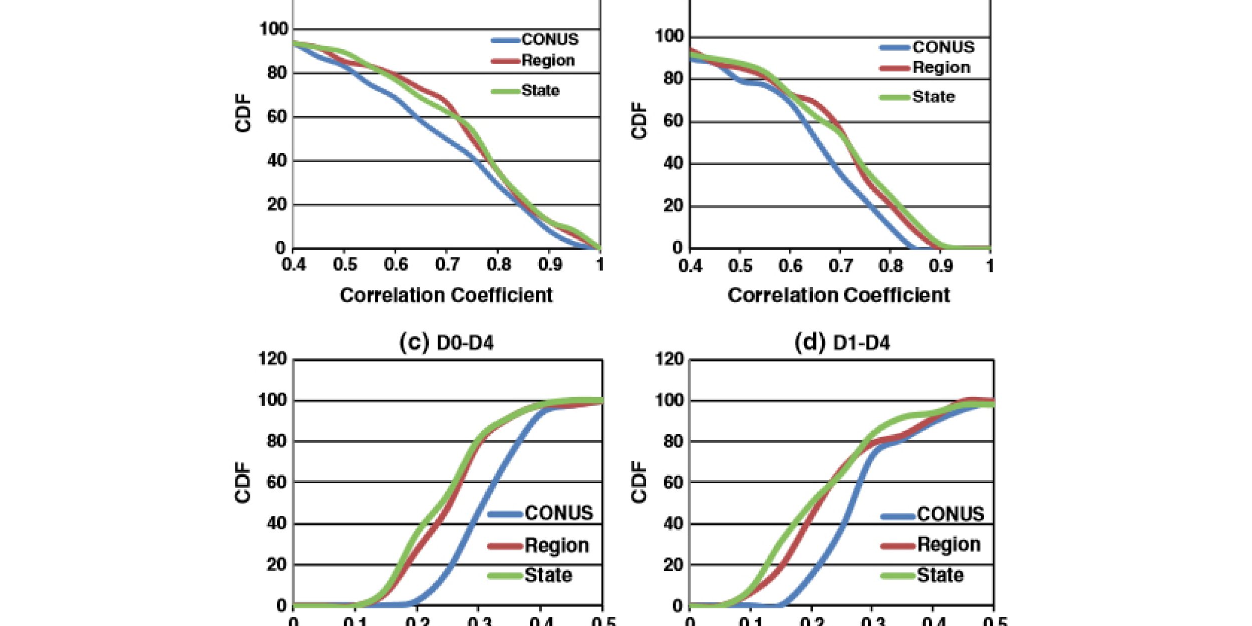
This study performs three experiments to calibrate the drought area percentages in the continental United States, six U.S. Drought Monitor regions, and 48 states downloaded from the U.S. Drought Monitor archive website.The corresponding three experiments were titled CONUS, Region, and State, respectively.


The data sets used in these experiments are from the North American Land Data Assimilation System Phase 2 (NLDAS-2) and the main purpose is to develop an automated Drought Monitor-based approach to objectively generate and reconstruct Drought Monitor-style drought maps using NLDAS-2 data by mimicking 10 year (2000–2009) Drought Monitor statistics.
According to the scientists, the results show that State and Region have larger correlation coefficients and smaller root-mean-square error and bias than CONUS when compared to the drought area percentages derived from the USDM, indicating that State and Region perform better than CONUS.
The paper was published online on March 21, but does not yet have a print publication date. To view the report online, visit: http://onlinelibrary.wiley.com/doi/10.1002/2013JD020994/abstract


Climate Program Office
Advancing scientific understanding of climate, improving society’s ability to plan and respond


Climate Program Office
Advancing scientific understanding of climate, improving society’s ability to plan and respond
Scroll to Top

