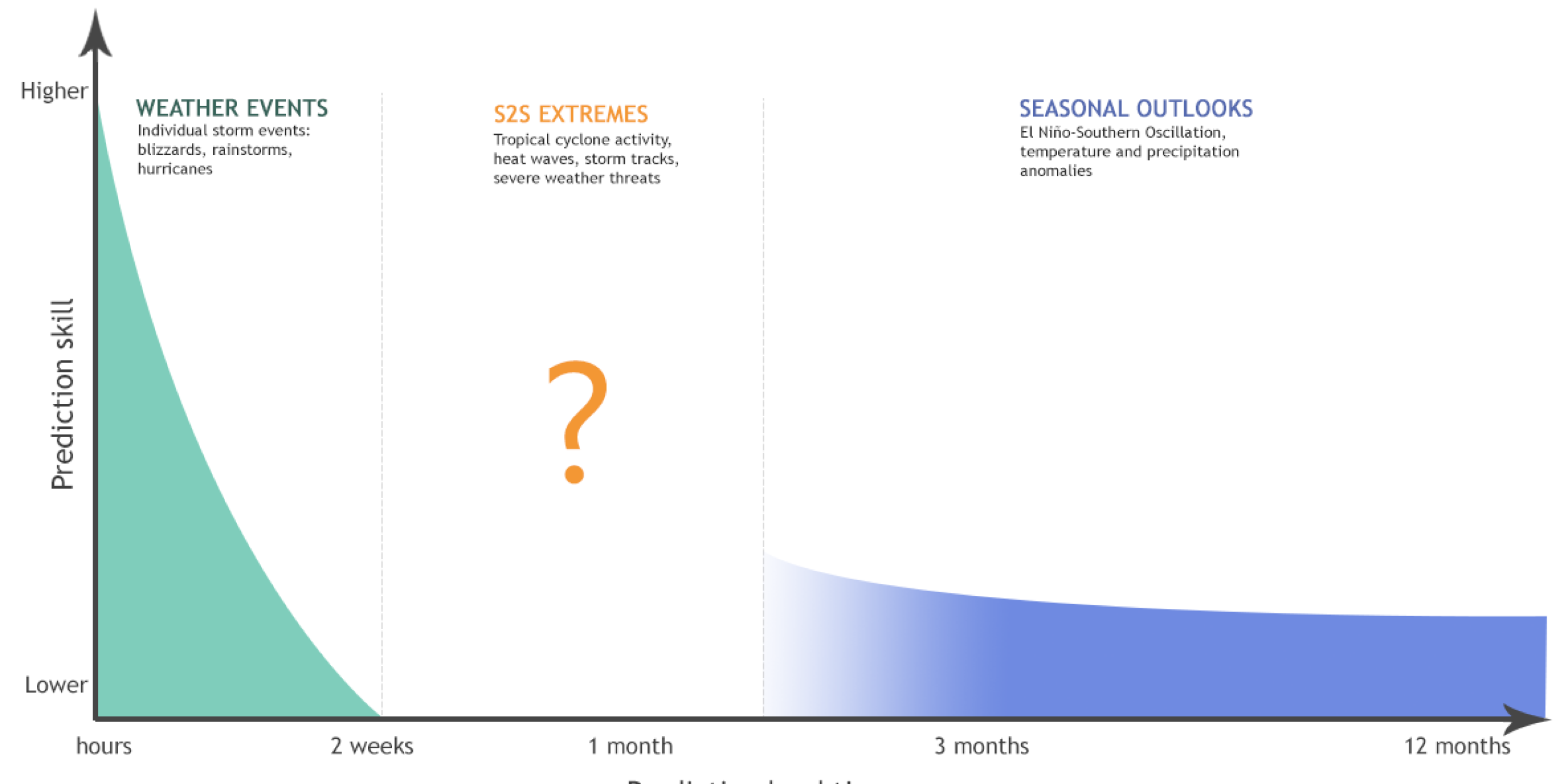
MAPP-funded research improves estimates of extreme weather and climate from two weeks to a season ahead. These predictions, known as subseasonal to seasonal (S2S), will advance NOAA’s ability to predict extremes, including heat waves, hurricanes, heavy precipitation, and extratropical cyclones. Image Credit: NOAA.
The NOAA OAR Climate Program Office Modeling, Analysis, Predictions, and Projections (MAPP) Program and the NWS Office of Science and Technology Integration Next-Generation Global Prediction System (NGGPS) Program will host a webinar on the topic of Sources of Predictability at Subseasonal to Seasonal Time Scales on Wednesday, May 24, 2017. The announcement is provided below.
| Date/Time | Title & Presenters |
|
May 24, 2017 10:00 AM – 11:30 AM ET |
MAPP-NGGPS Webinar: Sources of Predictability at Subseasonal to Seasonal Time Scales |
| Speakers and Topics | Frédéric Vitart(European Centre for Medium-Range Weather Forecasts (ECMWF) MJO Prediction and Teleconnections in Sub-seasonal Forecasts Cristiana Stan(George Mason University) Antje Weisheimer(University of Oxford and ECMWF) |
| Remote Access | To view the slideshow: 1. Click the link below or copy and paste the link to a browser: https://cpomapp.webex.com/cpomapp/onstage/g.php?MTID=e19baa2884bb6f51e4a43d91a4916fa53
|
| Watch Webcast |
ABSTRACTS
Frédéric Vitart – The Madden Julian Oscillation (MJO) is the dominant intra-seasonal mode of organized convective activity in the Tropics, with also a considerable impact in the middle and high latitudes. The skill of sub-seasonal forecasting systems to predict the MJO has improved significantly over the past decade, although most models still have difficulties propagating the MJO across the Maritime continent. The MJO predictive skill and teleconnections in the high latitudes have been diagnosed in 10 operational sub-seasonal prediction models from the WWRP/WCRP Sub-seasonal to Seasonal Prediction (S2S) database. Results suggest that the S2S models display skill to predict the MJO between 2 and 4 weeks, although the majority of S2S models tend to produce a too weak and slow propagating MJO in the extended forecast range. All the S2S models produce MJO extratropical teleconnections which are too weak over the Euro-Atlantic sector, which suggests that they do not fully exploit the predictability associated to the MJO in the Northern Extratropics. The impact of model resolution and ocean-atmosphere coupling on the MJO prediction skill and teleconnections will be discussed.
Cristiana Stan – The variability of the extra-tropics and its interaction with the tropics is studied at seasonal and intraseasonal time scales. Nonlinear oscillations in the extra-tropics are extracted from daily anomalies of 500-hPa geopotential for the period 1979-2012 using a data-adaptive method. One of the emerging global oscillations has a period of 120 days and over the North Atlantic region its pattern resembles the canonical North Atlantic Oscillation (NAO). A composite of the lifecycle of the 120-day oscillation shows that for the phase peak (phase 2) the pattern consists of a surface pressure dipole over the North Atlantic accompanied by cold (warm) surface temperature anomalies and anticyclonic wind at low-level to the north (south).
The 120-day oscillation was included as a predictor in an experimental version of the statistical forecast model used at CPC as part of the forecast tools for the Week 3-4 temperature and precipitation outlook. The influence of the predictor leads to mixed improvement and deterioration in cross-validated skill. The impacts on Week 3-4 U.S. temperature prediction appear most complimentary in boreal winter and when the MJO is over the Maritime Continent or West Pacific. Less skill is generally added when the MJO is over the Indian Ocean or forecast occurs during boreal summer.
Antje Weisheimer – Based on skill estimates from hindcasts made over the last couple of decades, recent studies have suggested that considerable progress has been made in forecasting winter climate anomalies over the Euro-Atlantic area using current-generation forecast models. However, previous-generation models had already shown that forecasts of winter climate anomalies in the 1960s and 1970s were less successful than forecasts of the 1980s and 1990s. Given that the more recent decades have been dominated by the NAO in its positive phase, it is important to know whether the performance of current models would be similarly skilful when tested over periods of a predominantly negative NAO.
To this end, a new ensemble of retrospective atmospheric seasonal forecasts covering the period 1900 to 2009 has been created, providing a unique tool to explore many aspects of atmospheric seasonal climate prediction. In this study we focus on the multi-decadal variability in predicting the winter NAO. The existence of relatively low skill levels during the period 1950s -1970s has been confirmed in the new dataset. This skill appears to increase again for earlier and later periods. Whilst these interdecadal differences in skill are, by themselves, only marginally statistically significant, the variations in skill strongly co-vary with statistics of the general circulation itself suggesting that such differences are indeed physically real. The mid-Century period of low forecast skill coincides with a negative NAO phase but the relationship between the NAO phase/amplitude and forecast skill is more complex than linear.


