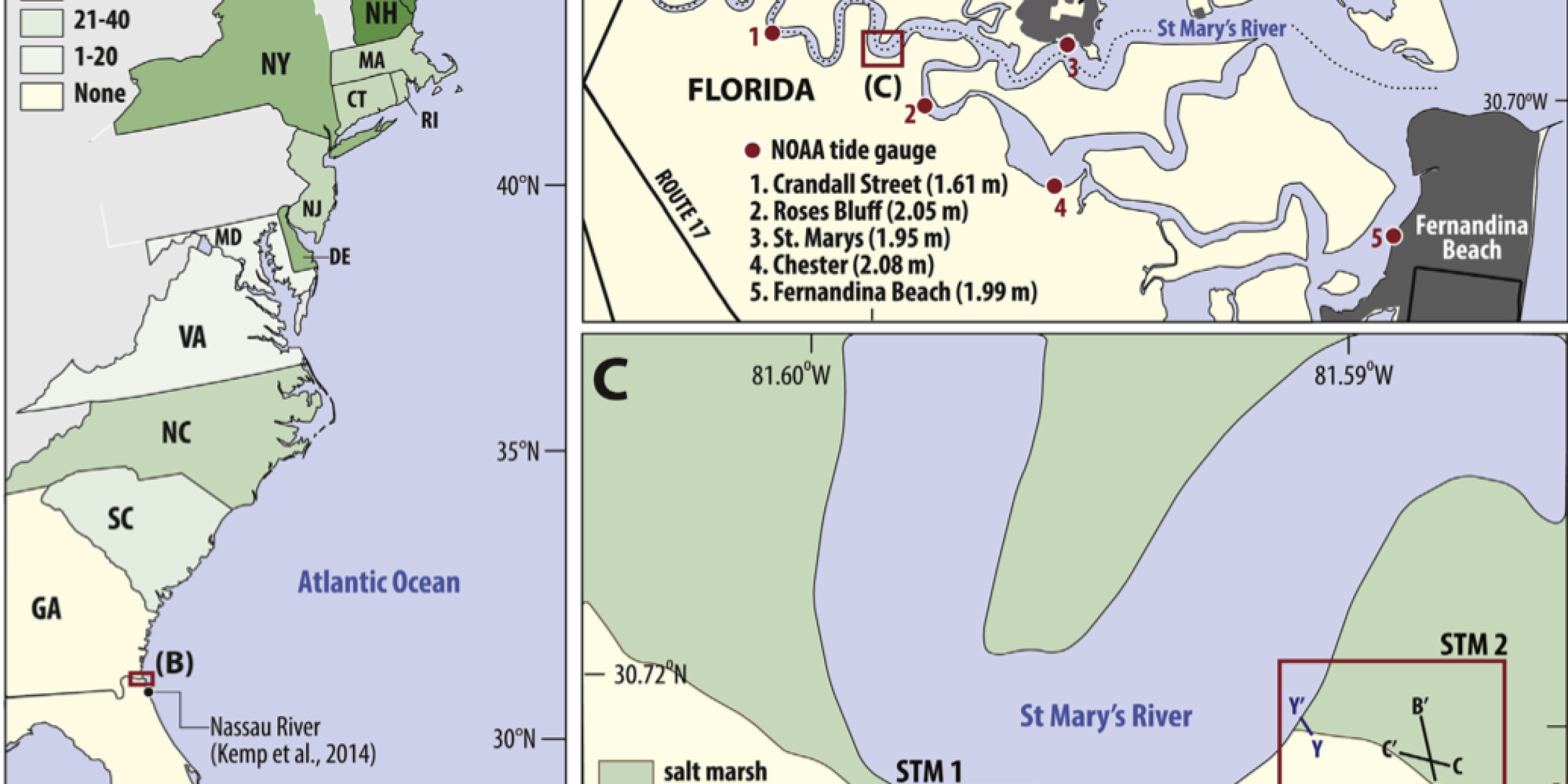
In the Atlantic coast of North America, regional-scale relative sea level has changed mostly because of movements of Earth’s crusts and melting glaciers during the Holocene, a period of time scientists study to better understand past, present, and future relative sea level change. Although studies of the US Atlantic coast have shed light on Holocene relative sea level, valid datasets for regions between Georgia and Florida are missing. These regions are important for testing Earth-ice models and relative sea level reconstructions in North America and the Caribbean.
A study funded in part by the CPO’s Climate Variability and Predictability program produced new sea level index points to address the lack of data between Georgia and Florida using foraminifera preserved in radiocarbon-dated salt-marsh sediment. A report of the study was recently published in Quaternary Science Reviews.


Abstract:
An existing database of relative sea-level (RSL) reconstructions from the U.S. Atlantic coast lacked valid sea-level index points from Georgia and Florida. This region lies on the edge of the collapsing forebulge of the former Laurentide Ice Sheet making it an important location for understanding glacio-isostatic adjustment and the history of ice-sheet melt. To address the paucity of data, we reconstruct RSL in northeastern Florida (St. Marys) over the last ~8.0 ka from samples of basal salt-marsh sediment that minimize the influence of compaction. The analogy between modern salt-marsh foraminifera and their fossil counterparts preserved in the sedimentary record was used to estimate paleomarsh surface elevation. Sample ages were determined by radiocarbon dating of identifiable and in-situ plant macro- fossils. This approach yielded 25 new sea-level index points that constrain a ~5.7 m rise in RSL during the last ~8.0 ka. The record shows that no highstand in sea level occurred in this region over the period of the reconstruction. We compared the new reconstruction to Earth-ice models ICE 6G-C VM5a and ICE 6G-C VM6. There is good fit in the later part of the Holocene with VM5a and for a brief time in the earlier Holocene with VM6. However, there are discrepancies in model-reconstruction fit in the early to mid Holocene in northeastern Florida and elsewhere along the Atlantic coast at locations with early Holocene RSL reconstructions. The most pronounced feature of the new reconstruction is a slow down in the rate of RSL rise from approximately 5.0 to 3.0 ka. This trend may reflect a significant contribution from local- scale processes such as tidal-range change and/or change in base flow of the St. Marys River in response to paleoclimate changes. However, the spatial expression (local vs. regional) of this slow down is un- determined and corroborative records are needed to establish its geographical extent.
Access the full paper: http://dx.doi.org/10.1016/j.quascirev.2016.04.016


