CPO’s Earth Radiation Budget (ERB), Atmospheric Chemistry, Carbon Cycle and Climate (AC4), and Climate Variability & Predictability (CVP) programs, in partnership with NESDIS STAR, are announcing four new 3-year projects originally funded in Fiscal Year (FY) 2023. The competitively-selected projects total $3 million in grant awards and aim to demonstrate the value of satellite observations in improving our understanding of cloud and aerosol properties.
Aerosols are microscopic solid or liquid particles suspended in air that significantly affect Earth’s weather, air quality, and climate. These particles are also the components of air pollution most responsible for disease and death both within the U.S. and abroad. Improving our understanding of the role of aerosols in the Earth system is essential for providing more accurate weather forecasts and reliable climate projections and for informing future climate adaptation and mitigation strategies.
There were two primary goals of the “Applications of satellite data to aerosol research” competition. The first goal was to improve our capacity in leveraging the wealth of satellite data already available to better understand the role of aerosols in the Earth System.
The second goal was to better understand how satellite observations resolve cloud and aerosol properties. By utilizing satellite observations in new and improved ways, the projects will demonstrate that satellite observations are an indispensable tool for understanding the role aerosols play in Earth’s energy budget, air quality, and climate.
This competition invited proposals on satellite data applications focused on one or more of the following areas: cloud-aerosol interactions, composition and fate of wildfire smoke, air quality forecasting, Earth’s radiative budget, health impact studies, cloud processes, and other improvements of physics and chemistry in models used for weather prediction and climate projections.
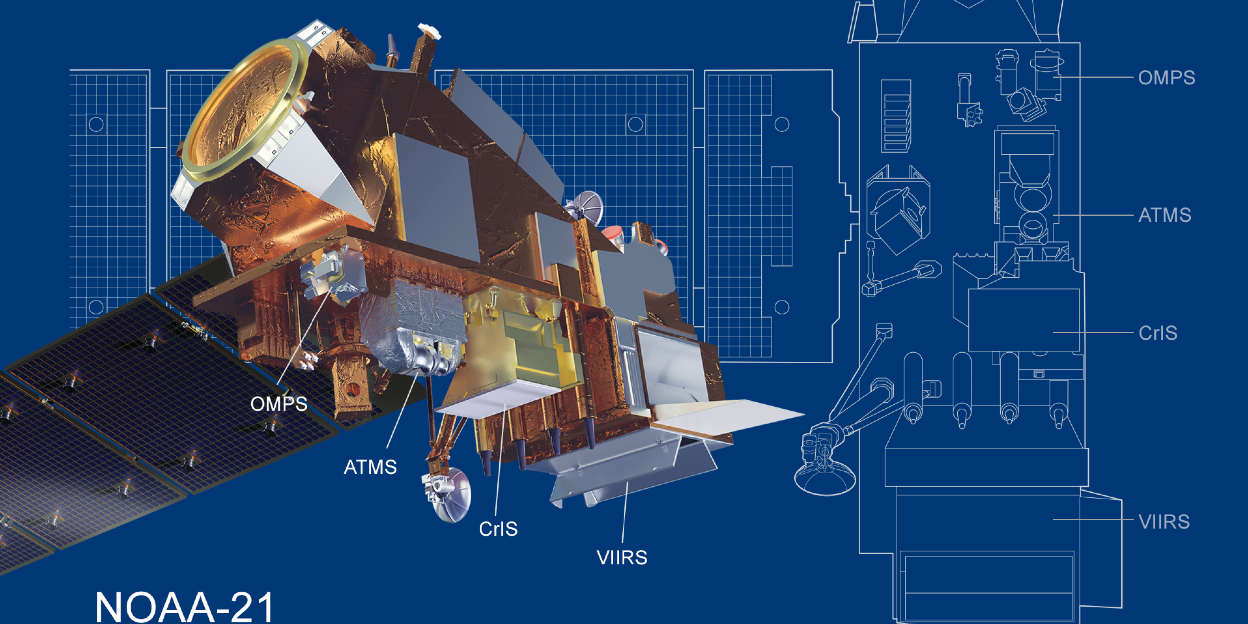
The selected research collaborations will make a number of key new advances including improving how we retrieve routine aerosol data from satellites and validating new aerosol data from recently-launched satellites like TEMPO and NOAA-21. Projects will improve the incorporation of satellite data into air quality models, especially in the case of wildfire smoke, and increase our understanding of shipping emissions. Some studies will also improve the detection of clouds from satellites and provide a better understanding of the radiative impacts of near-cloud aerosols. Notably, several projects make use of data from past NOAA field campaigns (ATOMIC, AEROMMA, and FIREX-AQ).
The four new projects funded by ERB, AC4, and CVP are:
- Advancing aerosol retrievals in the vicinity of clouds through remote sensing, 3-D radiative transfer, and state-of-the-art cloud modeling
- Lead PI: Graham Feingold (NOAA/Chemical Sciences Laboratory (CSL))
- Co-PIs: Christine Chiu (Colorado State University), Jan Kazil (CIRES at CU Boulder)
- Overview: Satellite retrievals of aerosol properties currently discard data near clouds due to complex effects, which causes a significant underestimation of aerosol optical depth and the direct aerosol effect, and uncertainty in the assessment of the role of aerosols for climate. This project will characterize aerosol hygroscopic growth and advance aerosol optical depth (AOD) and other aerosol property retrievals applicable to complex, highly 3-D, cloud-aerosol environments. The retrieval is unique, based on a machine-learning approach that accounts for both 3-D radiative effects and aerosol hygroscopic growth. To provide observational constraints for aerosol retrievals, we will characterize the aerosol field near clouds using data acquired during the ATOMIC and EUREC4A field programs. The outcome of this effort will be a substantial advancement in aerosol retrievals in the vicinity of clouds, which uses real field data, takes advantage of the process level understanding afforded by large-eddy simulations, and can be used to better understand and quantify the systematic errors associated with standard 1-D aerosol retrievals. Furthermore, by retrieving aerosol in the near-cloud zone, it will provide a more accurate estimate of the aerosol direct radiative effect.
- Generalizability of ship tracks to historical aerosol-cloud interactions and marine cloud brightening: Are there differences between sulfur, soot, and salt tracks?
- Lead PI: Michael Diamond (Florida State University)
- Co-PI: Tianle Yuan (University of Maryland, Baltimore County and NASA Goddard Space Flight Center)
- Co-PI: Hua Song (Science Systems and Applications, Inc. and NASA Goddard Space Flight Center)
- Overview: Inadvertent aerosol perturbations like ship tracks have inspired proposals to offset global warming impacts with deliberate aerosol cooling (e.g., marine cloud brightening). This project will analyze satellite retrievals of cloud and radiation properties within a shipping corridor in the southeast Atlantic, expanding on a “top-down” universal kriging method that estimates what mean cloud properties would be without shipping and a “bottom-up” method that uses machine learning to detect individual ship tracks. To determine if the recent switch from sulfur tracks to soot tracks changes cloud adjustments in ship tracks, the team will contrast satellite-derived cloud adjustments before and after the International Maritime Organization sulfur regulations that took effect in 2020. Finally, the team will use a large eddy simulation model to explore potential differences between sulfur, soot, and salt tracks and compare results with those from the satellite observations to help determine if either flavor of ship track is a good analogue for marine cloud brightening with salt tracks.
- Combining aerosol composition and optical properties measurements from the AEROMMA airborne field mission to evaluate and improve satellite data products
- Lead PI: Daniel Cziczo (Purdue University)
- Co-PIs: Adam Ahern (CIRES at CU Boulder)
- Overview: Satellites provide an unprecedented opportunity to increase our understanding of the abundance, characteristics, and life cycles of atmospheric aerosols by providing measurements with global and routine coverage. However, the quantities measured by satellites are far removed from the microphysical, chemical, and optical properties that govern the effect of particles on clouds, radiation, visibility, and human health. As a part of the NOAA AEROMMA campaign, aerosols were measured in a range of North American environments. While this dataset will provide a foundation for comparison with the satellite retrievals, significant calculations and verifications are required to make a meaningful connection between satellite retrievals and in situ measurements. This project will build on and leverage fieldwork to generate a bottom-up, validated aerosol optical model to represent the atmosphere that is viewed by satellite instruments like TEMPO, MODIS, and VIIRS.
- Improving the representation of aerosols from wildfires in air quality forecast systems leveraging multiple satellite products
- Lead PI: Siyuan Wang (CIRES at CU Boulder)
- Co-PIs: Jun Wang (University of Iowa); Arthur Mizzi (CIRES at CU Boulder), Mariel Friberg (University of Maryland, College Park), Congmeng Lyu (CIRES at CU Boulder)
- Overview: Due to widespread population growth in the wildland-urban interface, wildfires pose a greater risk to human health and properties. As a result, wildfires are a vital component in modern air quality forecast systems. This project focuses on improving the wildfire representation in air quality forecast systems with novel technological advances (large eddy simulation, machine learning, data assimilation), leveraging multiple satellite products. The integrated modeling system and associated developments will be evaluated using airborne observations from previous field campaigns (NOAA/NASA FIREX-AQ, NOAA CALFIDE) as well as nationwide ground-based observations (EPA AirNow, NASA AERONET, Pandora network, etc). Several project deliverables (new plume rise scheme and wildfire emissions) may be directly translated to operational models (HRRR-Smoke, RRFS-CMAQ) and other research/operational models.


