Official websites use .gov
A .gov website belongs to an official government organization in the United States.

Secure .gov websites use HTTPS
A lock ( ) or https:// means you’ve safely connected to the .gov website. Share sensitive information only on official, secure websites.

NIHHIS News

Citizen Scientists Take to the Streets to Map the Hottest Places in Ten U.S. Cities

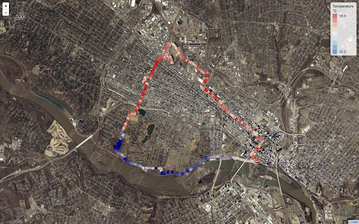
Citizen scientists will take to the streets during the hottest days this summer to map hot spots in ten different U.S. cities. The campaign is part of a NOAA-funded project to map places where buildings, asphalt, and other parts of urban environments can amplify high temperatures, putting people at heightened risk of heat illness during extreme heat events.

Citizen Scientists Take to the Streets to Map the Hottest Places in Ten U.S. Cities Read More »

Climate Resilience Toolkit Publishes New Case Study on Heat Illness Early Warning in the Carolinas

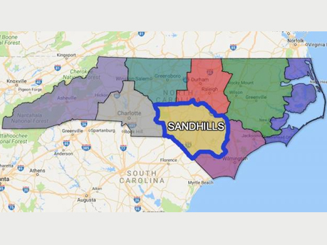
Residents of the Carolinas are familiar with hot summers, but in some areas excessive heat events bring a higher risk for heat-related illness—and even death. A new tool can help local communities get ahead of heat events so they can reduce risk for their residents.

Climate Resilience Toolkit Publishes New Case Study on Heat Illness Early Warning in the Carolinas Read More »

NOAA and ESRI Team Up to Create New Tools for Heat Health Understanding, Planning, and Analysis for the GEO Plenary

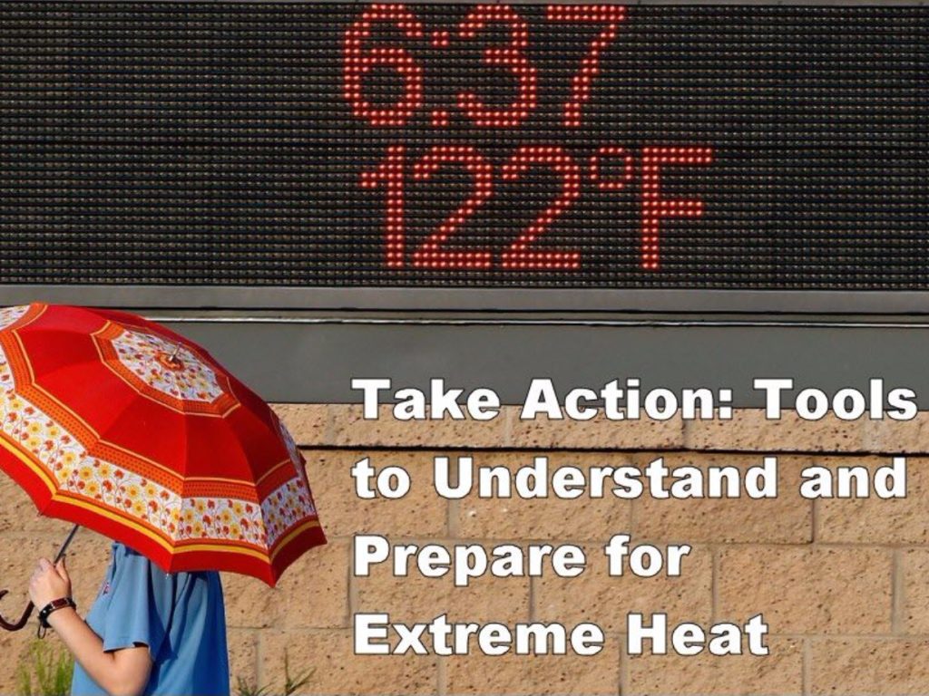
A new set of visualizations and analytical tools to understand, prepare for, and respond to extreme heat and its human health impacts (including economic impacts), has been prepared as an ESRI Story Map, developed in cooperation with NOAA and the NIHHIS Interagency Working Group. The story map includes a number of powerful tools which can also be used as stand-alone analytical web apps. The collaboration will continue, and the tools will be refined over time. The story map will be unveiled officially at the upcoming GEO Plenary in Washington DC, the week of 23 October 2017, and we encourage any and all with interest in climate and health to attend the open sessions and side meetings on Monday and Tuesday of that week – particularly the GEO Health Community of Practice on Tuesday afternoon. For more information on the GEO plenary, visit: http://www.earthobservations.org/geo14.php

NOAA and ESRI Team Up to Create New Tools for Heat Health Understanding, Planning, and Analysis for the GEO Plenary Read More »

NOAA’s Chief Scientist, Dr. Rick Spinrad, addresses COP21 participants regarding NOAA’s Integrated Information Systems

Dr. Rick Spinrad, NOAA’s Chief Scientist, addressed participants of the United Nations Framework Convention on Climate Change (UNFCCC) Conference of the Parties (COP) 21 and international viewers in a video presented at the US Center. The session, Healthy People, Healthy Planet: US Programs and Partnerships for Health Resilience was hosted by the Department of State and involved EPA and HHS. In his address, Dr. Spinrad underscored the importance of robust, sustained integrated information systems (IISes) for providing environmental information that spans the weather-climate continuum and supports resilience to climate and health challenges faced in the 21st century and beyond. These IISes not only provide “the right information at the right scales, far enough in advance, along with the right tools” for decision-makers, but also serve as “gateways for improving our research, observations, and prediction capabilities”. Dr. Spinradhighlighted the National Integrated Heat Health Information System (NIHHIS), which is being developed to integrate NOAA’s advancements in observing, understanding, and modeling the Earth system with societal needs for resilience to extreme heat – not only with US partners such as the CDC, but also with international partners including India and Germany. Additionally, Dr Spinrad called out the pilot Cholera Integrated Information System in Bangladesh, which NOAA is developing cooperatively with the World Health Organization (WHO) to support development goals.

NOAA’s Chief Scientist, Dr. Rick Spinrad, addresses COP21 participants regarding NOAA’s Integrated Information Systems Read More »

National Integrated Heat Health Information System (NIHHIS) Web Launch: May 23, 2016

The National Integrated Heat Health Information System (NIHHIS) – a NOAA-CDC collaboration that facilitates an integrated approach to extreme heat risk reduction by providing a suite of decision support services to prevent heat related illness and death – is launching its web presence on Monday, May 23, 2016. The NIHHIS portal will serve as the nexus for heat-health information from NOAA, CDC, FEMA, DOD, OSHA, SAMHSA, ASPR, NIH, EPA, and others, and will point decision makers to case studies, tools, trainings, reports, and other resources that inform decisions and reduce heat-related risk.

National Integrated Heat Health Information System (NIHHIS) Web Launch: May 23, 2016 Read More »

NOAA Releases Summer Climate Outlook for 2017

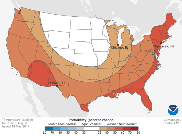
Schools are letting out, Memorial Day is nearly here, and for many Americans that means  the unofficial start of summer. And if it’s summer, then it ‘s time to start paying attention to the risk of extreme heat. According to NOAA’s summer outlook, most of the United States is favored to have a hotter than average summer in 2017. Only in the Great Plains do forecasters think the chances for a cool or a normal summer are equal to the chances of a hot summer. Everywhere else—from Alaska to southern California, and from Maine to Texas—odds are tilted toward well above average warmth. The absolute highest chances for a much warmer than usual summer are in Hawaii. (see the large version of the map below for Hawaii and Alaska.

NOAA Releases Summer Climate Outlook for 2017 Read More »

Scroll to Top